Architecture
An end-to-end integrated solution for smarter mineral exploration — from field sensors to orbit to AI-rated drilling targets.
Three steps from ground truth to drill-ready insight
Aemine collects
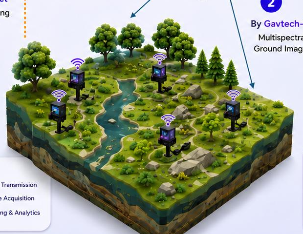
Seismic data is captured in the field by Aemine IoT sensor nodes — geophone and accelerometer arrays running fully off-grid — and relayed via satellite store-and-forward.
Gavtech-Sat observes
Our hyperspectral satellite captures multispectral ground images over the same areas of interest, turning the sensor grid into a correlated observation network.
Gavtech.AI decides
AI-powered software fuses processed IoT data with ground imagery, overlays mineral anomaly zones, and rates each target with a confidence score — before drilling.
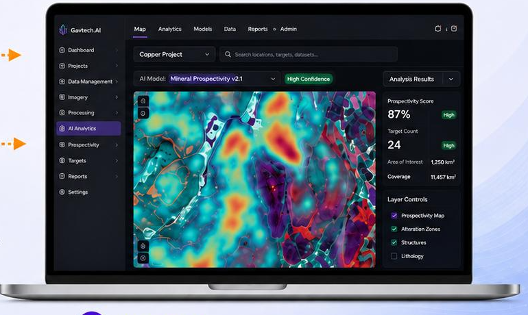
Mineral prospectivity, scored and ranked
Gavtech.AI ingests seismic event streams and hyperspectral scenes into a single correlation engine. The output: ranked mineral prospect polygons, each with a confidence score.
- Seismic events timestamped and GPS-tagged at node level
- Hyperspectral scenes ingested over the same areas of interest
- Anomaly zones overlaid on mineral spectral maps
- Ranked prospect polygons with confidence scores
A sensor network that works anywhere
Aemine nodes form multi-hop mesh clusters across remote prospect sites, with solar power and ruggedized enclosures. Satellite uplink means near-zero airtime cost on owned infrastructure — no cellular coverage required.
- Multi-hop mesh networking across 2–5 km clusters
- Solar-powered, fully off-grid operation
- Scheduled satellite uplink via store-and-forward
- One satellite, dual role: imagery platform and device comms uplink
Built for better exploration decisions
Where is this heading?
See our 2026–2030 product development roadmap.